Wednesday, February 1, 2017

Making "Pretty" Thumbnail Photos & Helpful Websites

Hello again!

So one of the tasks that I have been given is to create a "pretty" thumbnail photo for the map that will appear on ArcGIS Online as well as on the Collector app.
Generic Automatic Thumbnail

 At our organization, our thumbnail photos for our ArcGIS Online maps are the generic, ArcGIS standard map photos that are given to all thumbnails (as can be seen to the right). Since I had been reading up on how thumbnail photos can really convey the message that your map is trying to send before even actually opening the map, Heather and I decided that it was about time we attempted to create a "pretty" thumbnail photo.

Of course with me starting work in a new topic I had some questions on how to get started creating a thumbnail image, I did not know if there was some type of template that I should be following or if I just could create an image of somesort. ESRI's ArcGIS Blog and GeoNet community are two very helpful websites that I have been turning to for help as I venture along with this project. For any question that I have, or any tricky situation that I encounter, I turn to either one of those websites or I turn to gis.stackexchange.com where I can search through hundreds of previously answered(and some unanswered) questions to see if I am able to find a solution. Almost every question I have had thus far, someone else has had this question too and posted it to one of the websites for responses and discussion. I highly recommend using these websites for help and of course I recommend taking a look at the documentation that ESRI provides for each application/tool/etc. My last resort is calling customer service, because a lot of what I have been working on is completely brand new to me, I cannot explain to myself what is going on, let alone trying to explain it over the phone to somebody else. 99% of the time, one of the websites I mentioned can get me out of any ArcGIS jam that I have.

That being said, I found a helpful blog post on ESRI's ArcGIS Blog entitled, "Put Your Best Thumbnail Forward". The author of the post discussed the advantages to having a customized thumbnail for each map in your organization, and explained that for quality purposes, the thumbnail could only be 200 pixels x 133 pixels and in either PNG, JPEG, or GIF format. It appears as though most people who create appealing thumbnail photos are skilled in using graphics editors such as Photoshop. I have no recent experience in Photoshop so that option was out of the equation...I think that the last time I used Photoshop was in my 6th grade Computer Science class...which was a good 10+ years ago. I have experience in editing photos in Paint...which did not seem to work for me, until I remembered that PowerPoint could probably do the trick!

With Powerpoint, I was able to make the size of the slide equal to the 200 pixels x 133 pixels that are needed for the thumbnail photo, by converting the pixel size to inches. While I am not a graphic designer by any sort, I was able to make a decent photo containing the Pad Mount Transformer map, the North Attleboro Electric Department logo and an explanation of what the map contains. It may get tweaked as the project moves on, but for now, here is the new thumbnail photo for the Pad Mount Transformer Inspections map:


New and Improved Thumbnail

Wednesday, January 25, 2017

Making Progress

Hope everyone is doing well!

We have gotten quite a bit done on this project! My manager, Heather and I, along with another manager at the electric department and the people who will be conducting the inspections have created a database schema for the inspection application to work. What is a schema you ask? Well a schema is just a fancy word for an outline or a model of how something will look. In this case, the schema is an outline for how the inspection table will look, ie. which order the questions will be in, which fields are required which are not, etc.

Since we have the schema set, Heather and I have been testing how the Collector application works with our data. We have created a database in ArcGIS and have configured it with our data so that we are able to take our data offline. We have successfully published our map as a feature service to our server, so that we can securely access it through ArcGIS online, after having complications figuring out why the database would not register on the server. Once in ArcGIS online we have configured the pop-ups and settings so that the essentials will be available on the Collector app. Once the map was enabled for offline editing and shared with the group, I was able to test how Collector works on our IPad. It worked!

While all seemed well and good, we did run into a few problems. When setting up the database and map service, we had decided that we wanted our maps to be versioned. This means that while there is some default map, multiple people can work on other "versions" of the map without the changes being reflected on the default map. The default map only reflects the changes once it has gone through a reconciling process and a posting process. Basically, versioning is done so that edits are not made in error and it is a way to keep track of what data is getting updated and when. I had never worked with versioning before, nor had I ever worked with ArcServer so all of this was brand new to me. Because of this, I ran into errors while trying to download the map onto the IPad when using Collector, I was not supposed to check off a box when I registered the feature class as versioned. So I had to stop the service, unregister the data as versioned and then re-register it, while remembering not to check off the box.

Once we were able to fix that glitch, the edits we made on Collector were showing that they were synching to the server but we could not find those edits anywhere! It seems as though every time we managed to take a step forward, we had to take 5 steps back. Heather and I ended up talking on the phone to an ESRI rep who walked us through reconciling and posting our versioned data. We contacted the rep again the following day to help us enable photo attachments on our database.

This certainly is a learning experience for me! But I am happy to be doing it!

Wednesday, January 18, 2017

Full-Time Internship & Undergraduate Research!

Hi Everyone!

I'm sorry I did not post anything last semester! I was insanely busy last semester...want to know how busy?? I was taking 18 credits at school, while interning part-time at the North Attleboro Electric Department, working part-time at a local consignment shop, maintaining BSU's EarthView blog learning how to live on my own in my very first apartment, raising a 1-month old kitten AND planning my upcoming wedding (which is now 44 days away....eeek!!). How I ended up with a 4.0 GPA for the semester is all attributed to the fact that hard work pays off and that I find myself doing my best when I am stressed out...odd, but it works!

Anyways...the electric department decided to keep me on as their intern for the spring semester! I am beyond excited! I will be here full-time for the semester and will also be conducting undergraduate research with them! Because of these two wonderful opportunities, I only need two additional classes to graduate so I will be taking two online classes this semester and will be graduating May 13th...yippee! Married and a College graduate all within a couple months of each other, busy, busy!


Pad Mount Transformer
For my undergraduate research here, I will be helping the GIS manager to develop and use the Collector App by ESRI to conduct visual maintenance inspections of the Pad Mount Transformers in town. These inspections have never been done so methodically and organized before so this a great asset for the electric department to have. I am excited to see where this project takes the organization and I am excited to see where this internship takes me! Keep checking back as I will be posting every Wednesday through the end of the semester.


Friday, September 23, 2016

GIS Internship!

Hello there!


Image result for great hill trails bridgewater ma
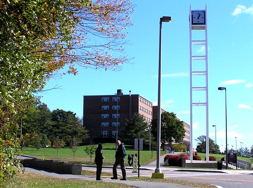
 The former clock tower at BSU
 
It sure has been a while since I last posted something on here...I apologize as I was very busy this summer working and planning my upcoming wedding!

Over this summer though I was able to work with the Director of the Fitness Center at BSU on updating the Great Hill Trail map that he and a former Geography student had created years back. The maps had been updated in 2013 but they needed a little revamp, especially considering that these maps were now going to have a designated spot at the trail head for hikers to take along with them. The map needed additions on two of the trails, objects needed to be removed from the map such as the clock tower, and the map display needed to be set on legal sized paper with an accordion fold. I worked on the map from about late June to late July and am happy to say that the map is on display at the Great Hill Trails trail head at Bridgewater State University and is also online on BSU's Athletic & Recreation's official website!

In other exciting GIS news, I went in for an interview at the North Attleboro Electric Department (on my birthday) for their GIS intern position. I left for Maine a few days later and got a phone call that I got the internship for the Fall semester! I of course took the offer and have been interning here since Sept 7th. My manager is even a graduate of BSU's Geography program. So far, I have been working on a map for a certain area in town making sure that the electrical account numbers match up with the spreadsheet of accounts and vice versa.
Image result for electricity
It is very cool to be able to apply the skills that I have learned in the classroom outside in the real world in a job setting. I am definitely fortunate and blessed that I have been given these great opportunities to use my GIS skills outside of school. I am excited to see where my journey with Geography and GIS will take me in the future!


For now, keep checking back here as I will post updates often as I am getting course credits for my internship and keeping up with this blog is part of what is required of me!


(: Eva

Wednesday, March 30, 2016

Great Blue Hill, Viewshed Analysis on ArcScene

Hello all!

For this week's homework, I was to create a Viewshed Analysis using ArcGIS online and ArcScene. I decided that I would do a Viewshed Analysis of The Great Blue Hill in Milton, Massachusetts. 
Blue Hill
                                   
What is a Viewshed Analysis you ask? Well, suppose you were 5'5" tall and decided to hike up to the top of the 635 foot tall Blue Hill, what would you see if you were to look across the landscape? The Viewshed Analysis tells you just that. On ArcGIS online, you are able to choose any location across the world and place in certain parameters to get the Viewshed Analysis for your selected area. For mine, I chose that the person standing on top of the Great Blue Hill would be 5'5" and that at most, they could see 9 miles out. Below is the Viewshed Analysis for the Great Blue Hill. The orange spots are the areas that you would be able to see. I haven't been up to to the top of the Great Blue Hill in a long time, I'd love to take a hike soon and see how far out I can see! 


Sunday, March 27, 2016

Solar-Wind Village Suitability in Adams, Ma

Happy Easter! 
I hope that you all are enjoying this beautiful Easter Sunday!

The most recent map that I have made for GIS dealt with the potential for a Solar-Wind Village Development in Adams, Massachusetts. I needed to find the locations in town that met the following criteria:

1. The site has to have a slope angle of 20° or less 
2. The slope has to have a southerly aspect (135° to 225°)
3. The wind speed at 30 m has to be above 5 m per second. 

I also needed to specify which locations were "highly suitable", "suitable" or had "limited suitability". The determinations for 

I was given an elevation raster of Adams and from that raster I needed to determine the slope and the aspect of the area. I then needed to obtain the wind speed raster from MassGIS and clip this New England raster down to just Adams.

Once I had found found the aspect of the Adams elevation raster, I used the raster calculator to get a layer of the wind speed and aspect that met criteria #2. I was then able to combine this layer with the slope layer that I had made through the process of determining the slope, reclassifying, and using the raster calculator on that layer. By combining these two layers I had a correct picture of all the criteria met, I just needed to reclassify it again so that the labels would be correct. 

Below is my finished map:

Sunday, March 13, 2016

Nunckatessett Greenway Map Journal

Hi all!

I'm sorry that I haven't been written since mid-February, my life has been very crazy!

Anyway...recently I have been working on the Nunckatessett Greenway Project and the last step of the project was to create a map journal on ArcGIS. 

To view my map journal please click here!

I hope that you enjoy the map journal! This project for class was certainly hard but rewarding! I'm happy to have had the opportunity to work on and improve my GIS skills while working on a real life project.