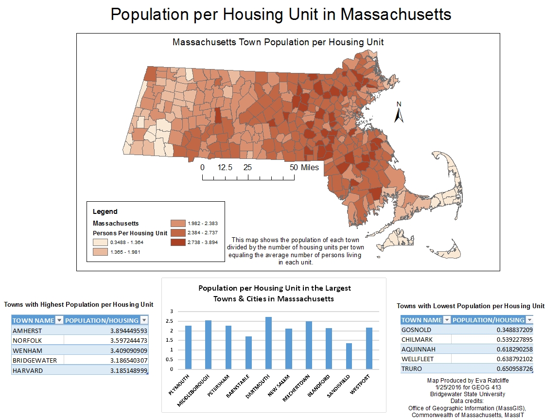
The map shows each town or city colored a shade of red based on the average number of persons living in a housing unit in that city or town. I have also included two tables describing the five towns with the highest amount of persons per housing unit and the five towns with the least amount of persons per housing unit. In addition to the tables, there is also a bar graph showing the persons per housing unit in the 10 largest cities and towns (size based on square miles not population).
I hope you enjoy the map!
No comments:
Post a Comment